Disaster Resilient Community Design
Project Overview
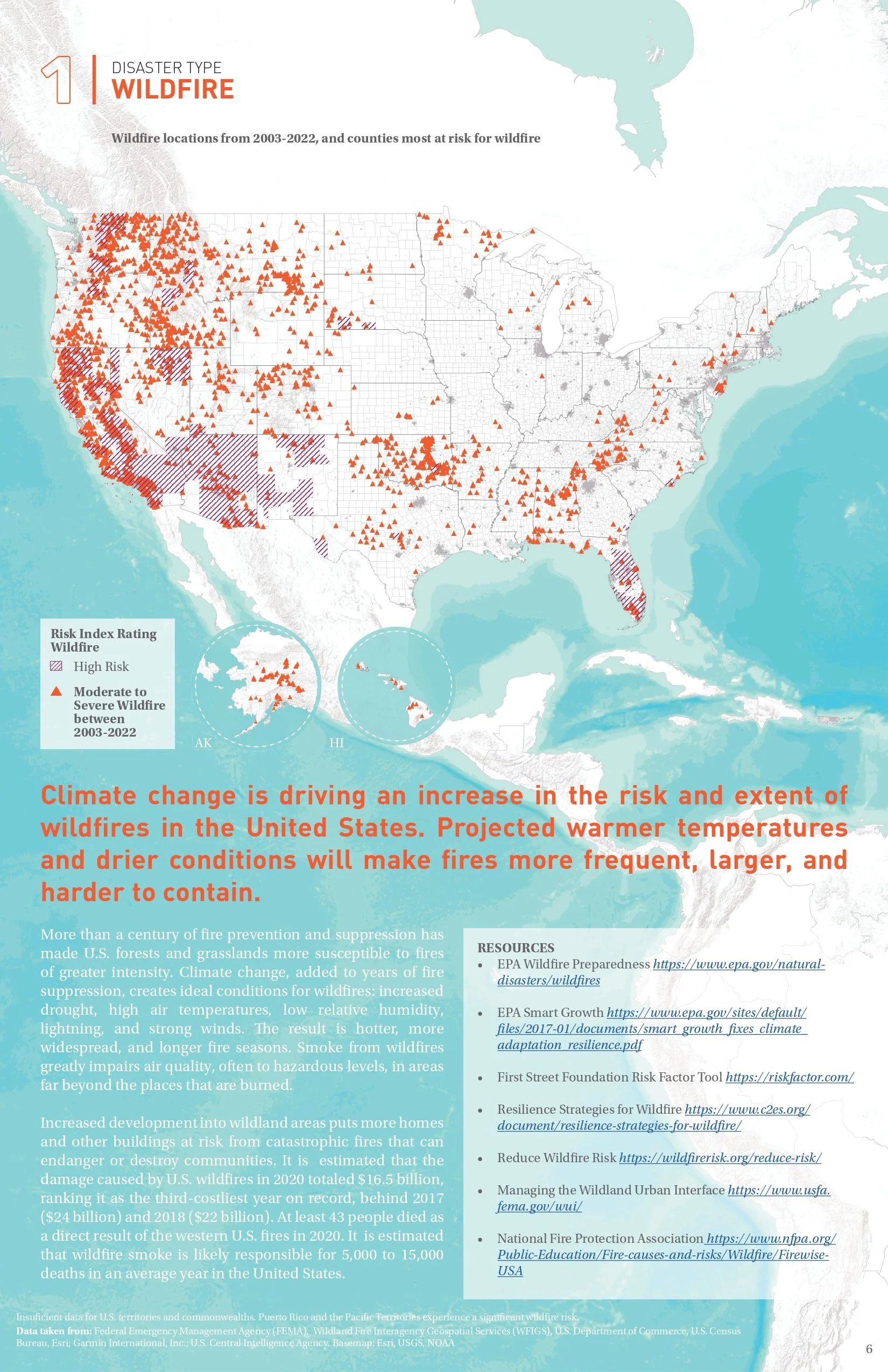
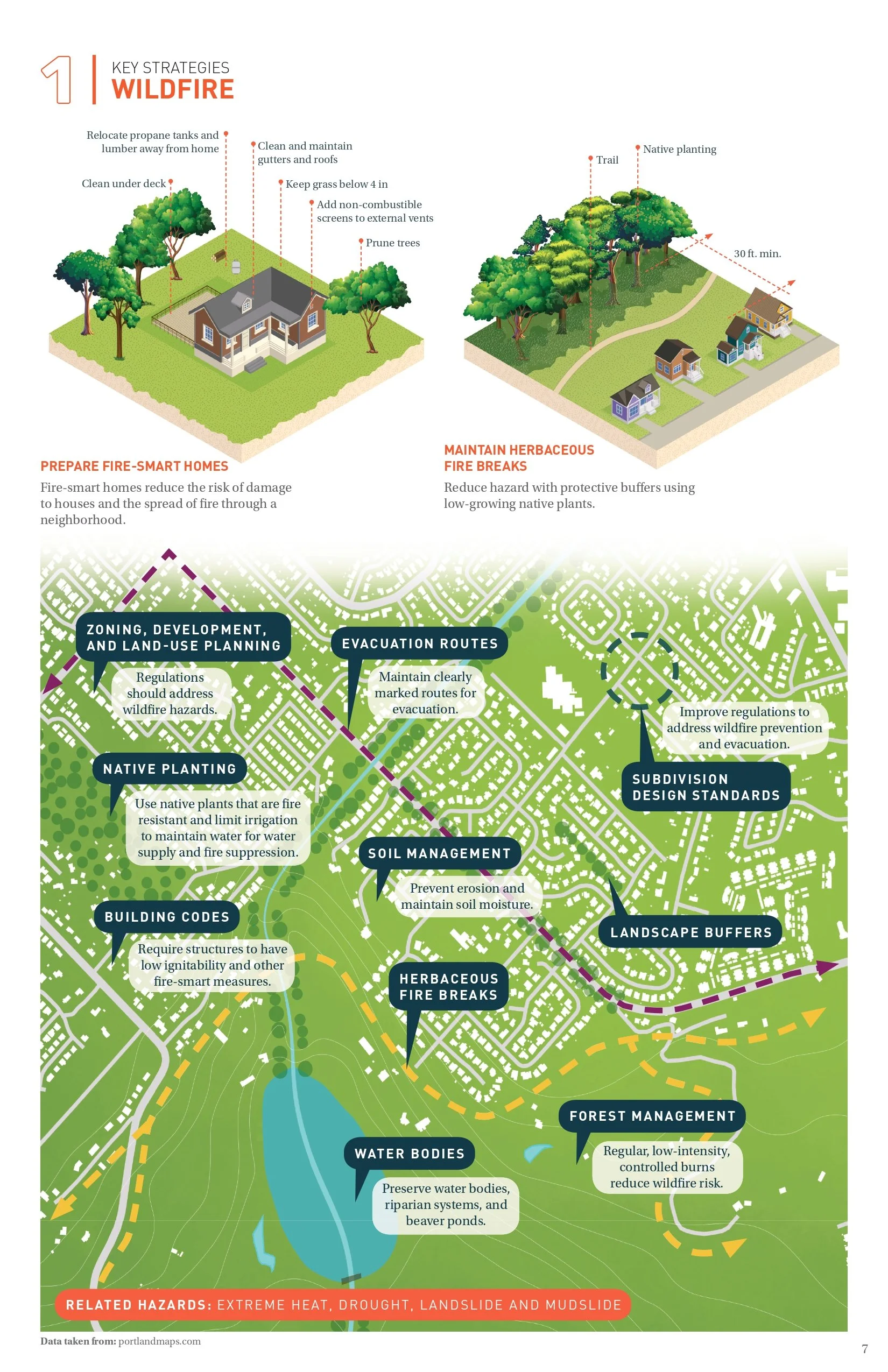
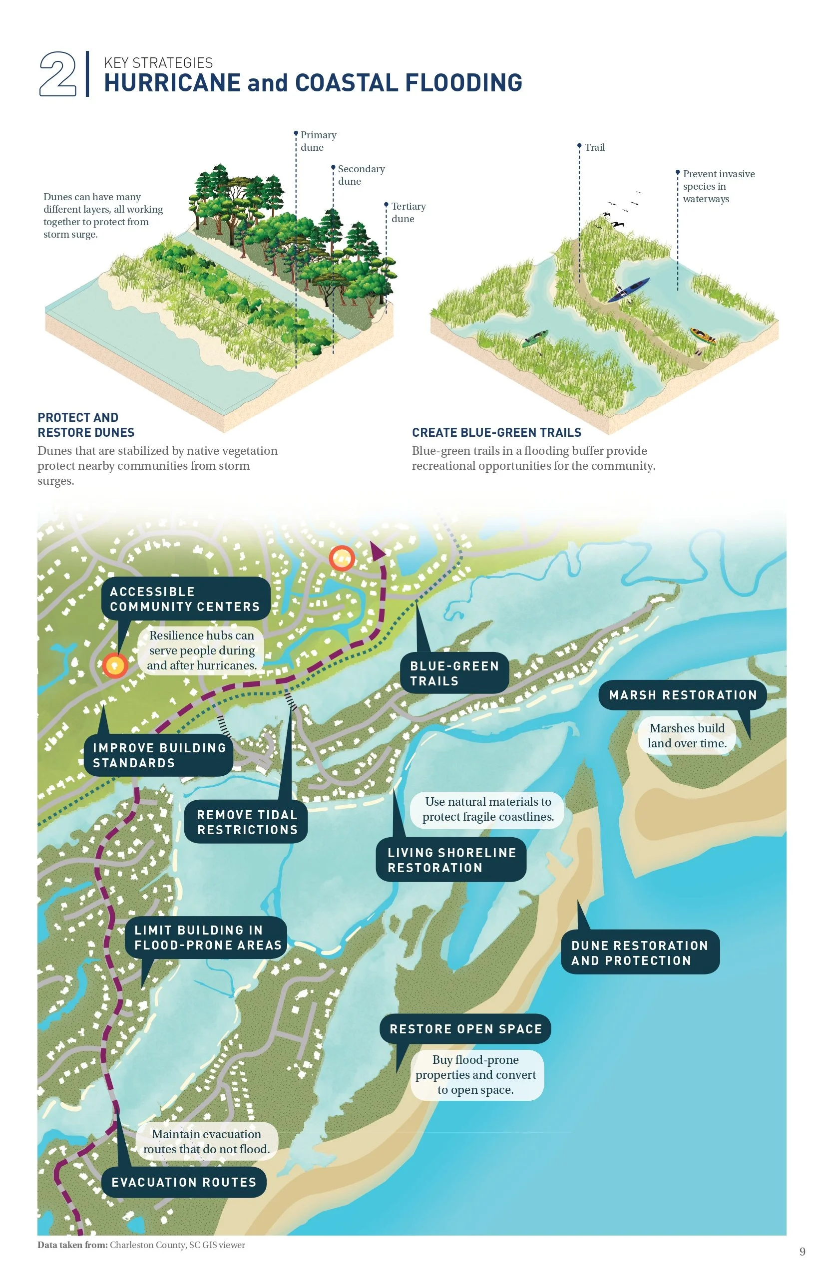
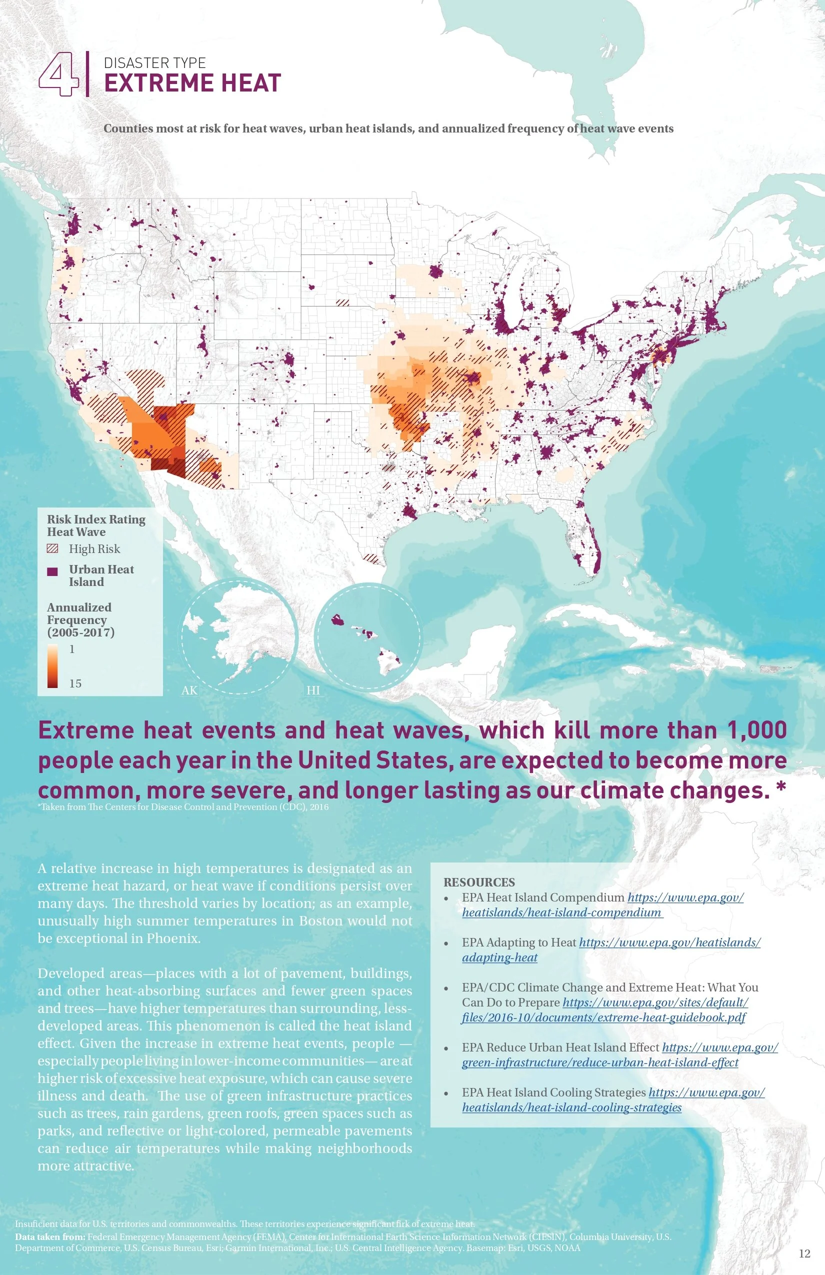
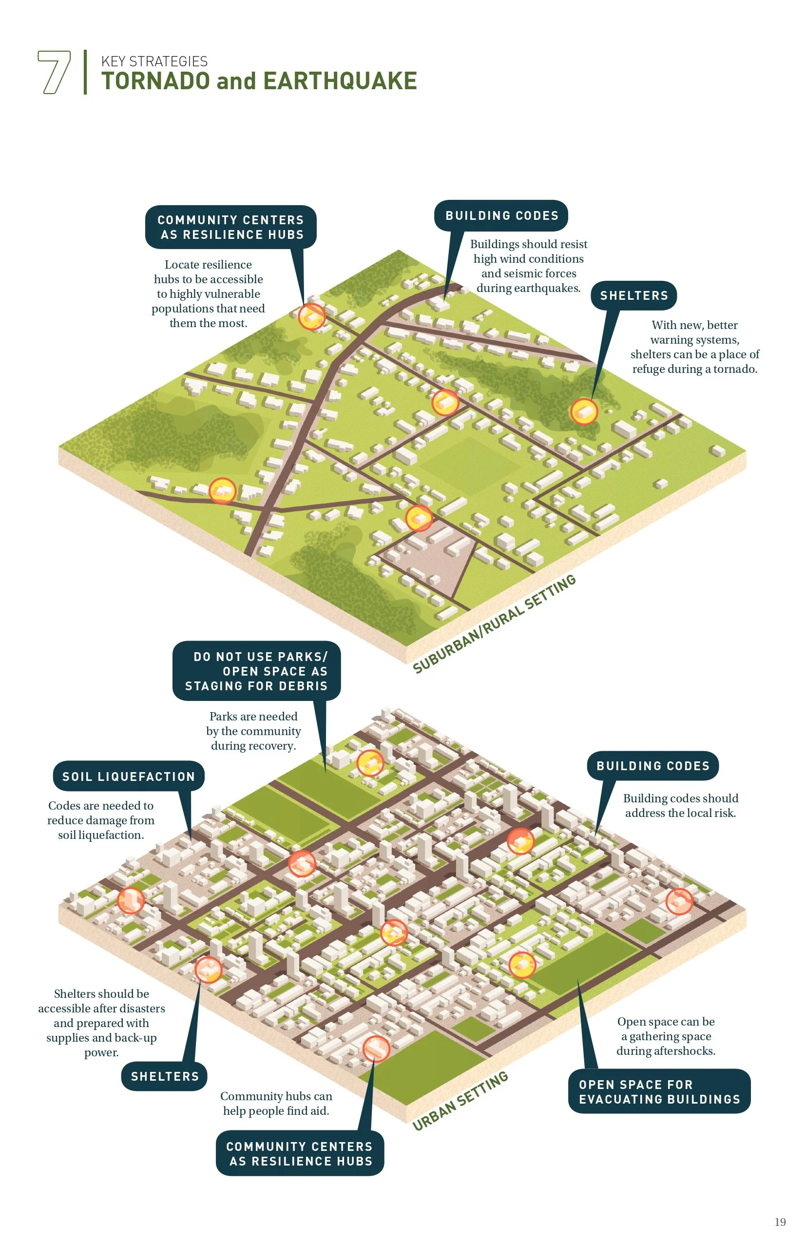
This project explores disaster-resilient design strategies that help communities across the United States mitigate the impact of natural hazards and accelerate recovery. It examines how to strengthen local economies, improve quality of life, and support native ecosystems, before and after disaster. As climate change intensifies threats and urban development expands into vulnerable areas, there is an urgent need for proactive, multi-functional design solutions. The work highlights a range of strategies, from forest management policies and updated building codes to nature-based infrastructure such as parks and stormwater systems. These solutions demonstrate how investments in public space and infrastructure can serve dual purposes, offering both climate resilience and community benefit. The project aims to inspire collaboration among diverse stakeholders including emergency managers, land use planners, utilities, parks and forestry departments, and community-based organizations.
My Role
I led and created the graphic designs and data visualizations for this project, transforming complex datasets into clear, compelling visuals that communicate both risk and opportunity. Using data from federal agencies such as the EPA, FEMA, and NOAA, as well as local and state sources from a variety of U.S. cities and communities, I created maps and graphics that illustrate the value of integrated, landscape-based design strategies. My work helped bridge the gap between technical data and public understanding, ensuring that key insights were accessible to decision-makers, practitioners, and community members alike.
Full report available at: epa.gov/smartgrowth/disaster-resilient-design-concepts
This project was completed during my time at SMM